Kleifarvatn
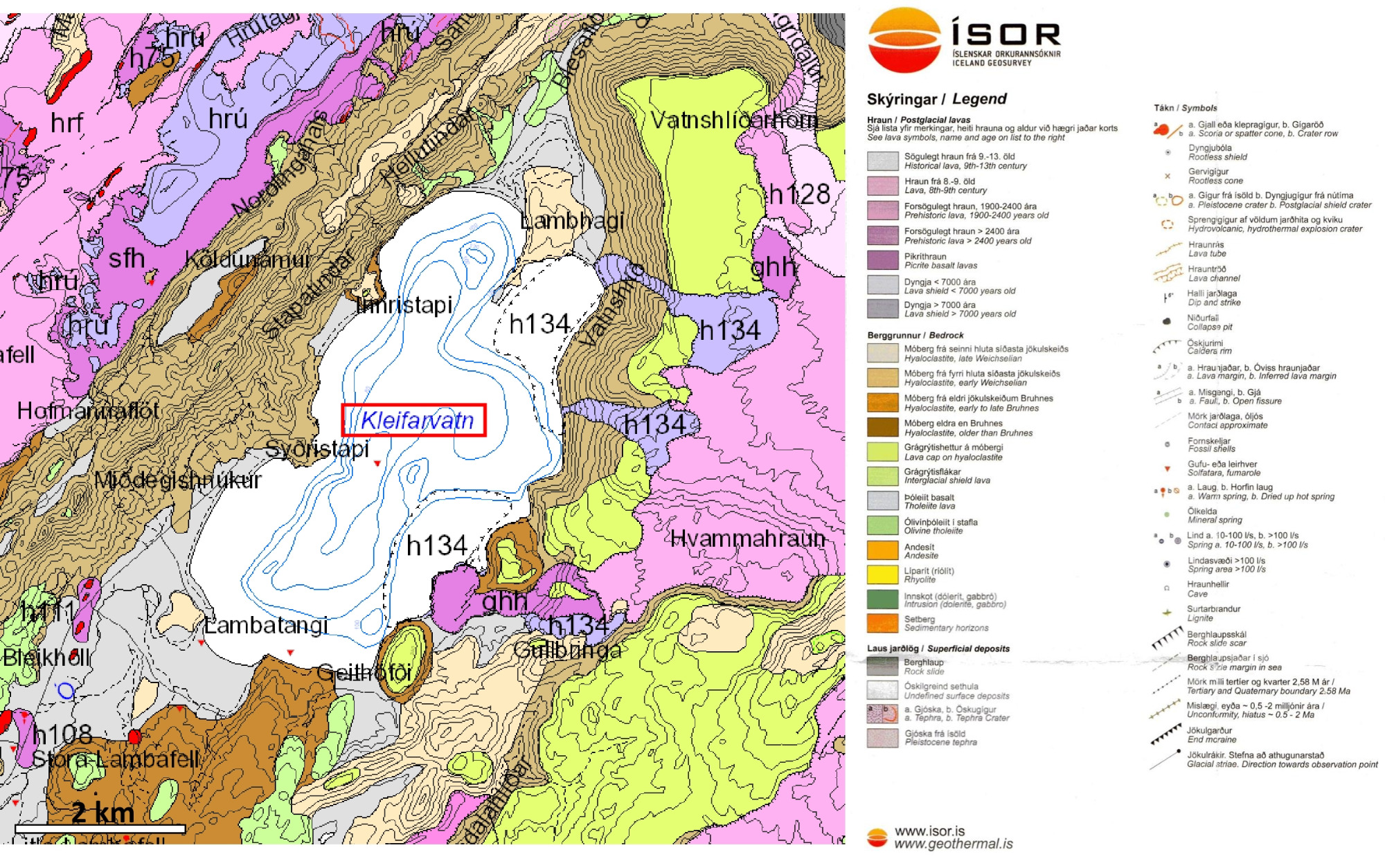
Kleifarvatn (63°55’32.70″N 21°59’50.89″W) is the result of groundwater flowing into a basin that constitutes the lake. No rivers or steams flow into or out of the lake. The lake reaches a maximum depth of 97 m. It is around 5.2 km long and has a width of up to 2.3 km. The size of the lake varies, depending on the fluctuations of the water surface. In 2000, a leakage in the lake was detected, which is thought to be caused by earthquake fractures, produced by an earthquake in June 2000. This leakage led to a lower lake surface, by several meters, and reduced the lake area for several years. The surface elevation and area are now back to normal. The strange shape or geometry of Kleifarvatn is largely controlled by several sets of fractures. These fractures are divided into four main groups, depending on their orientation around the lake: (1) northeast (related to plate-tectonic spreading or rifting; mostly normal faults), (2) north-south (earthquake fractures, strike-slip faults), (3) east-northeast (earthquake fractures, strike-slip faults), and (4) northwest (orthogonal tension fractures, formed by fluid pressure). The entire shape and shore of the lake are mostly controlled by these fractures (Guðmundsson, 2017).
Guðmundsson, Á. (2017). The glorious geology of Iceland’s Golden Circle. Springer. 334 pp.