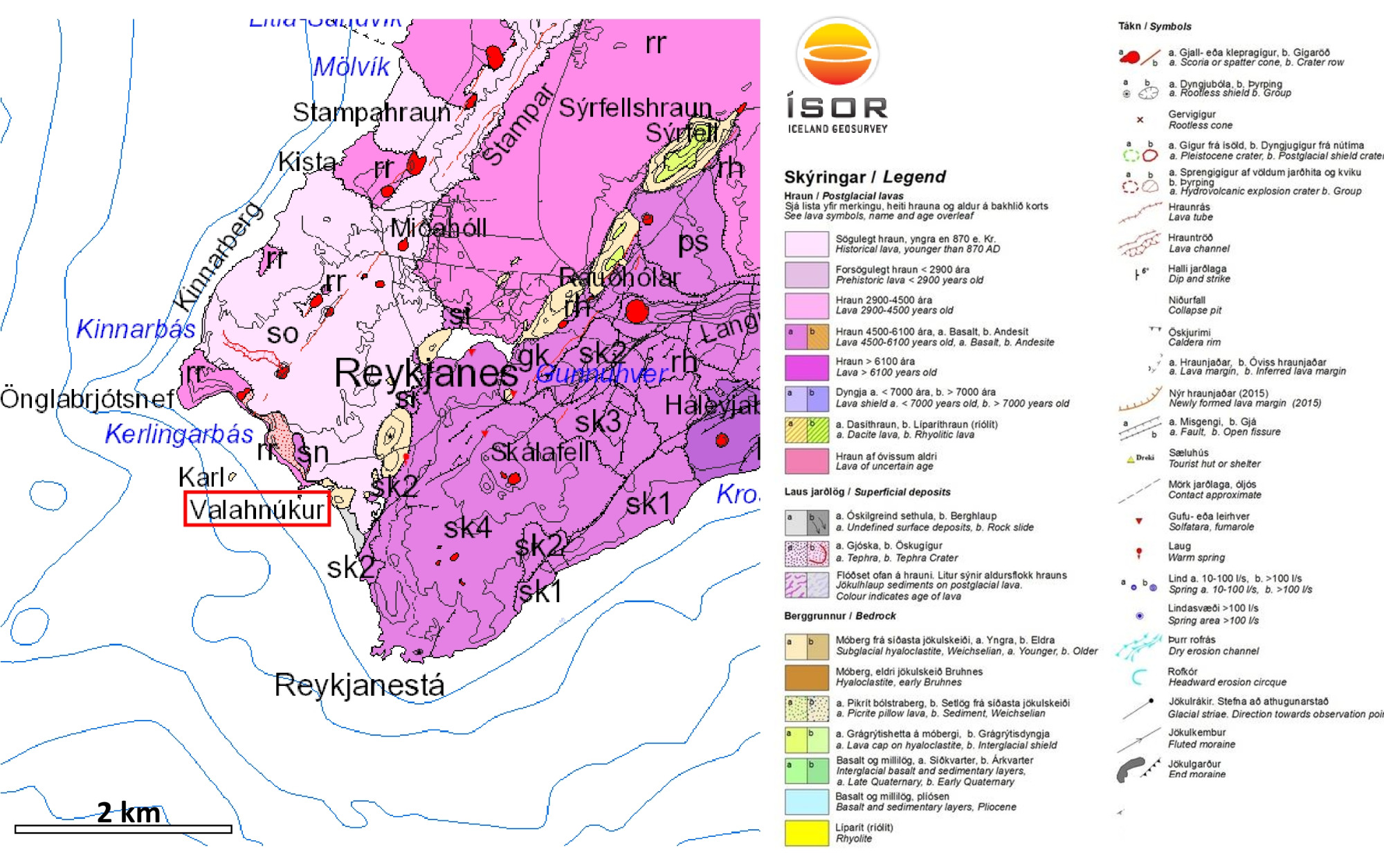
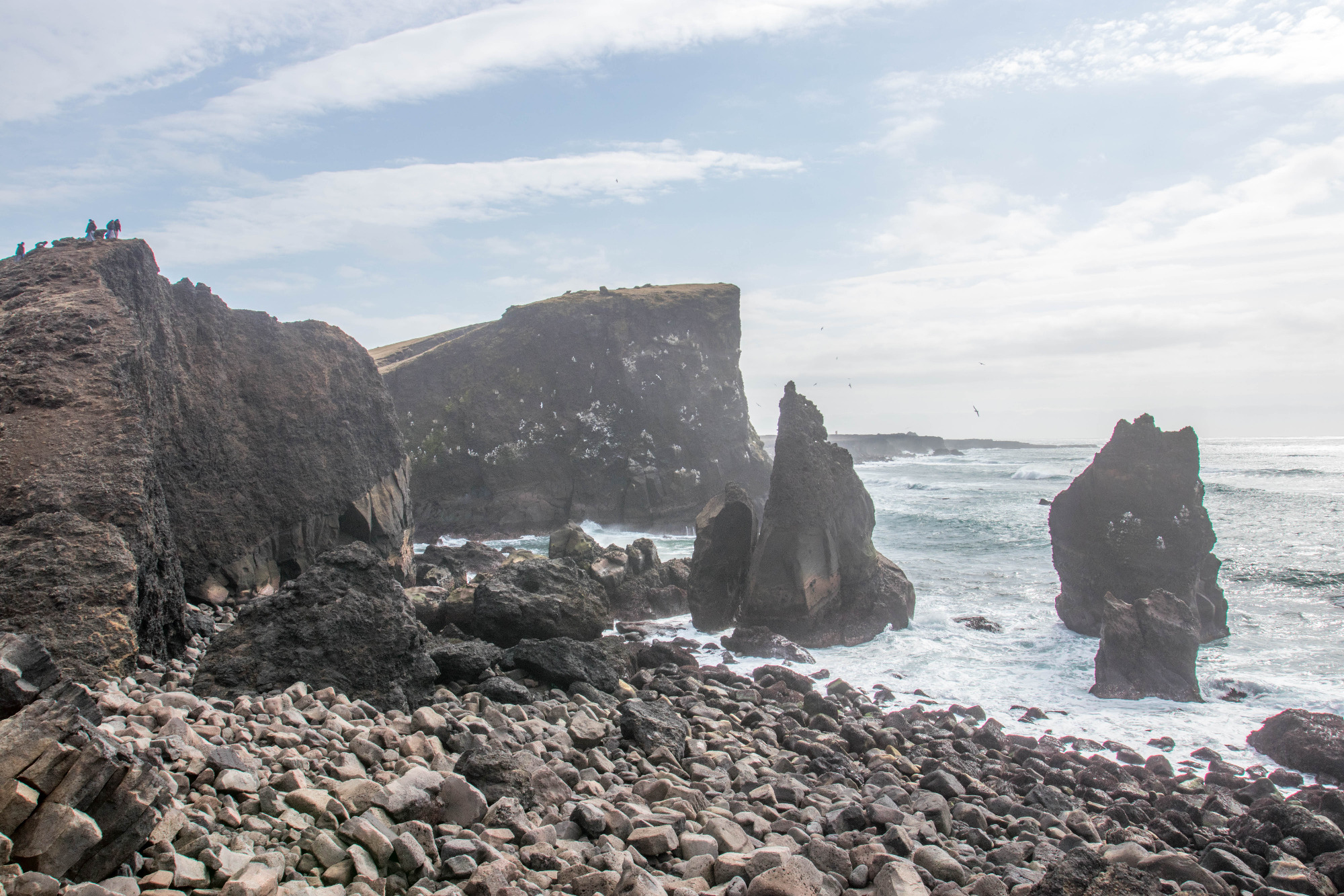
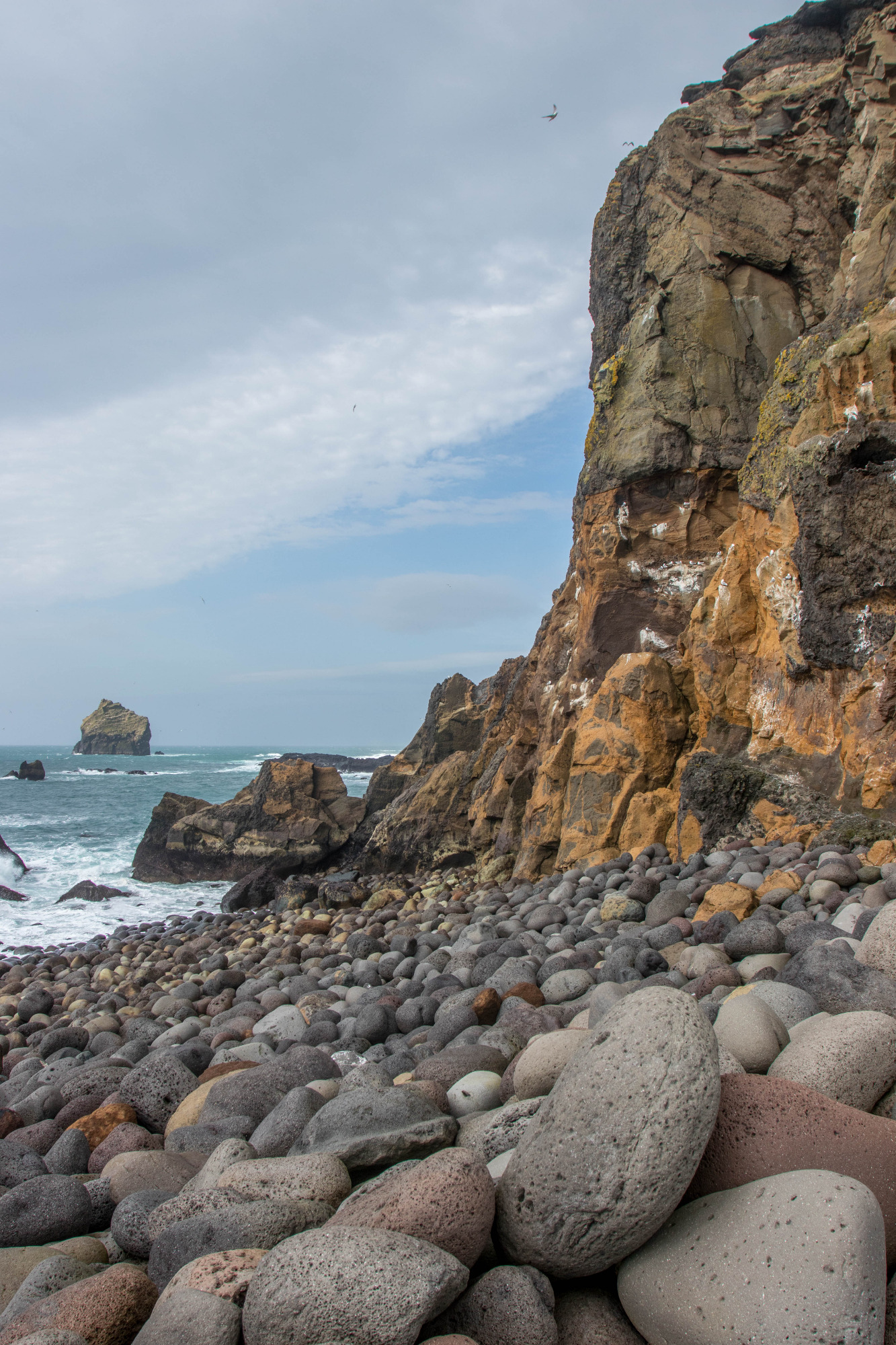
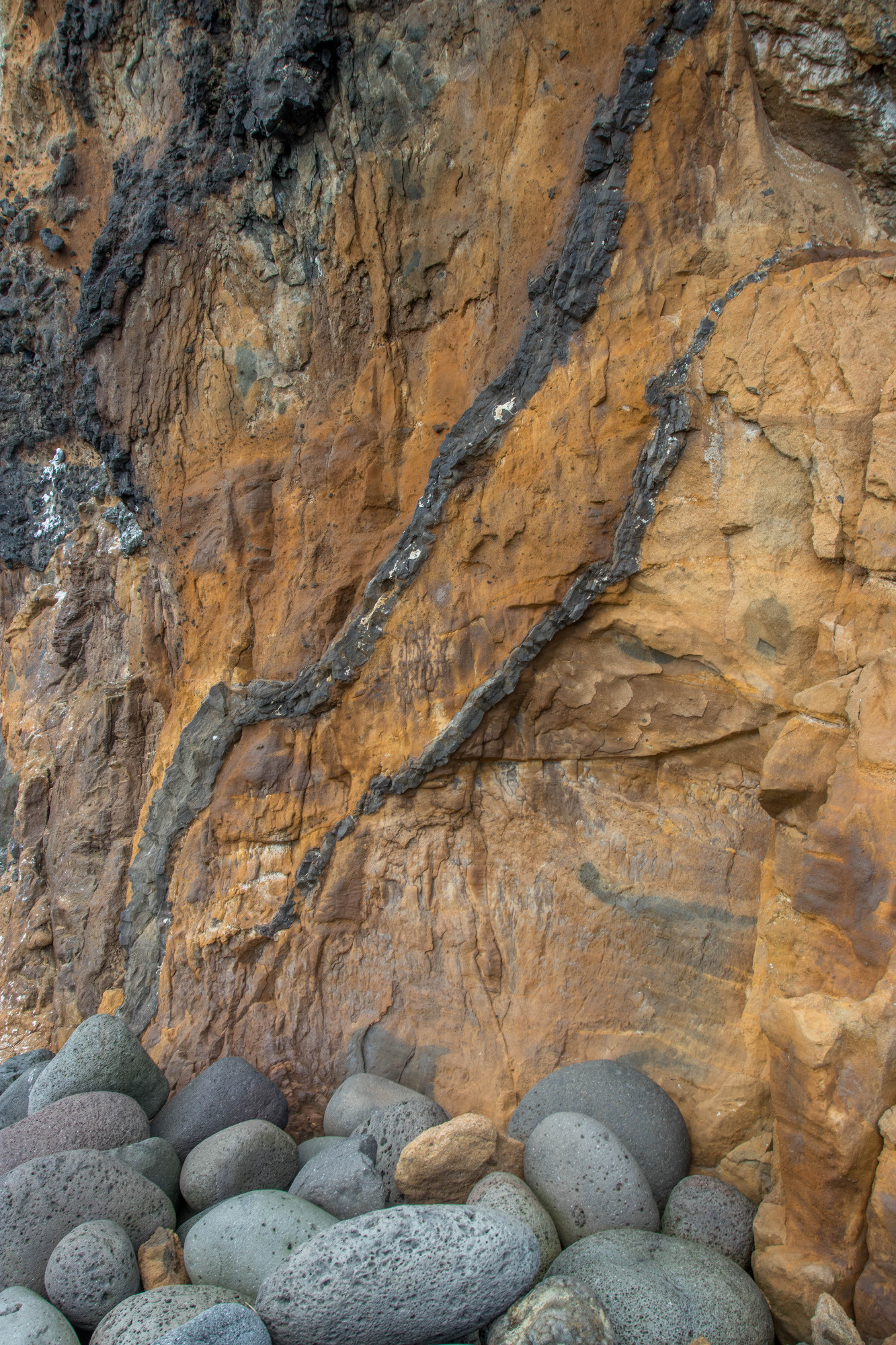
Valahnúkamöl
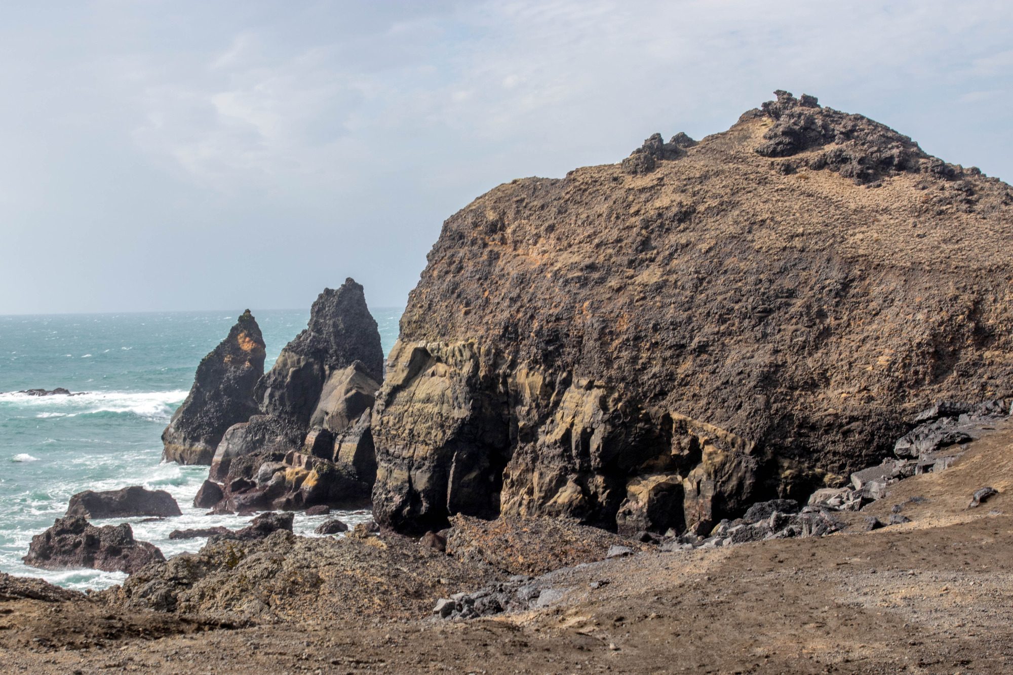
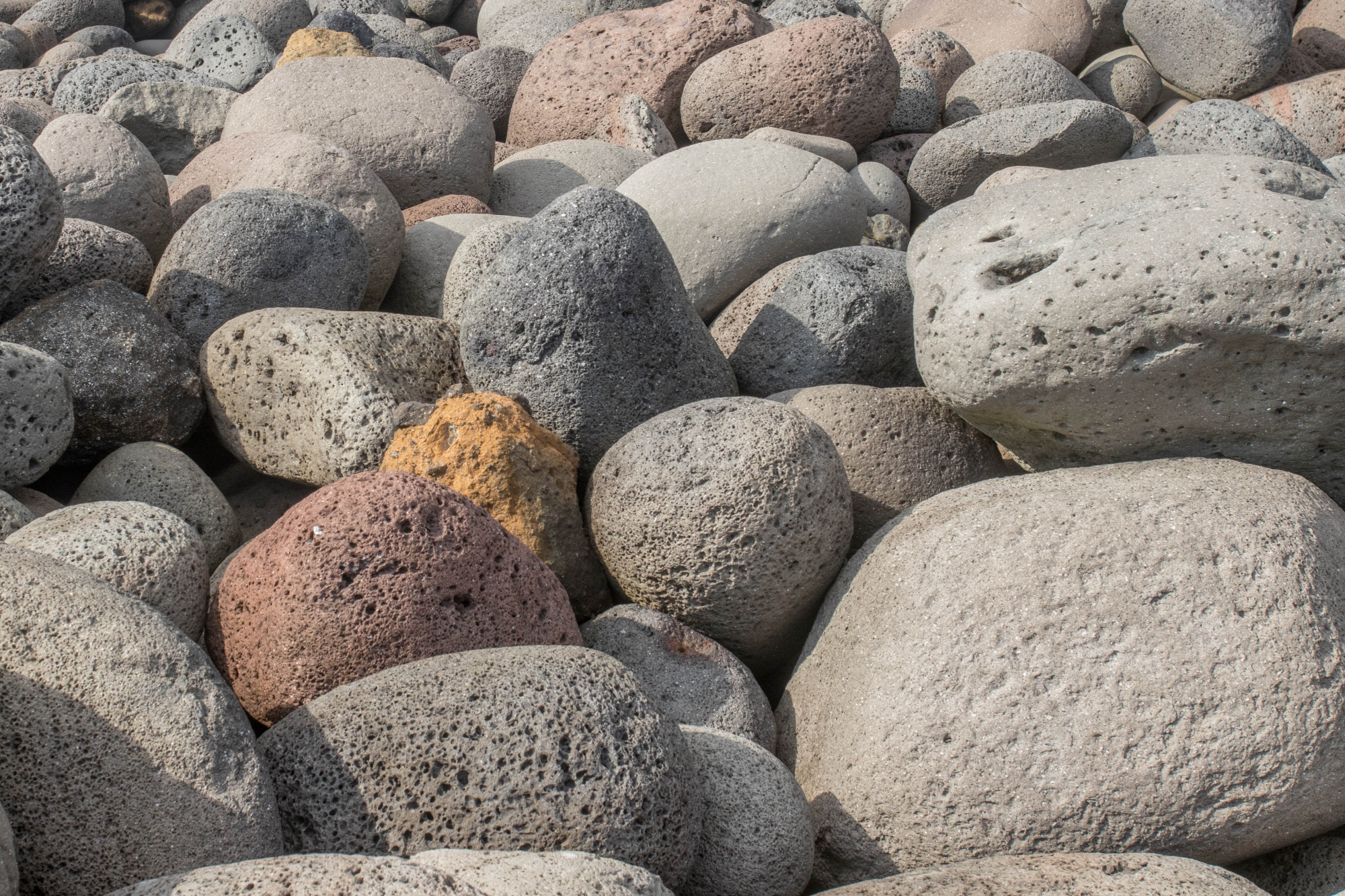
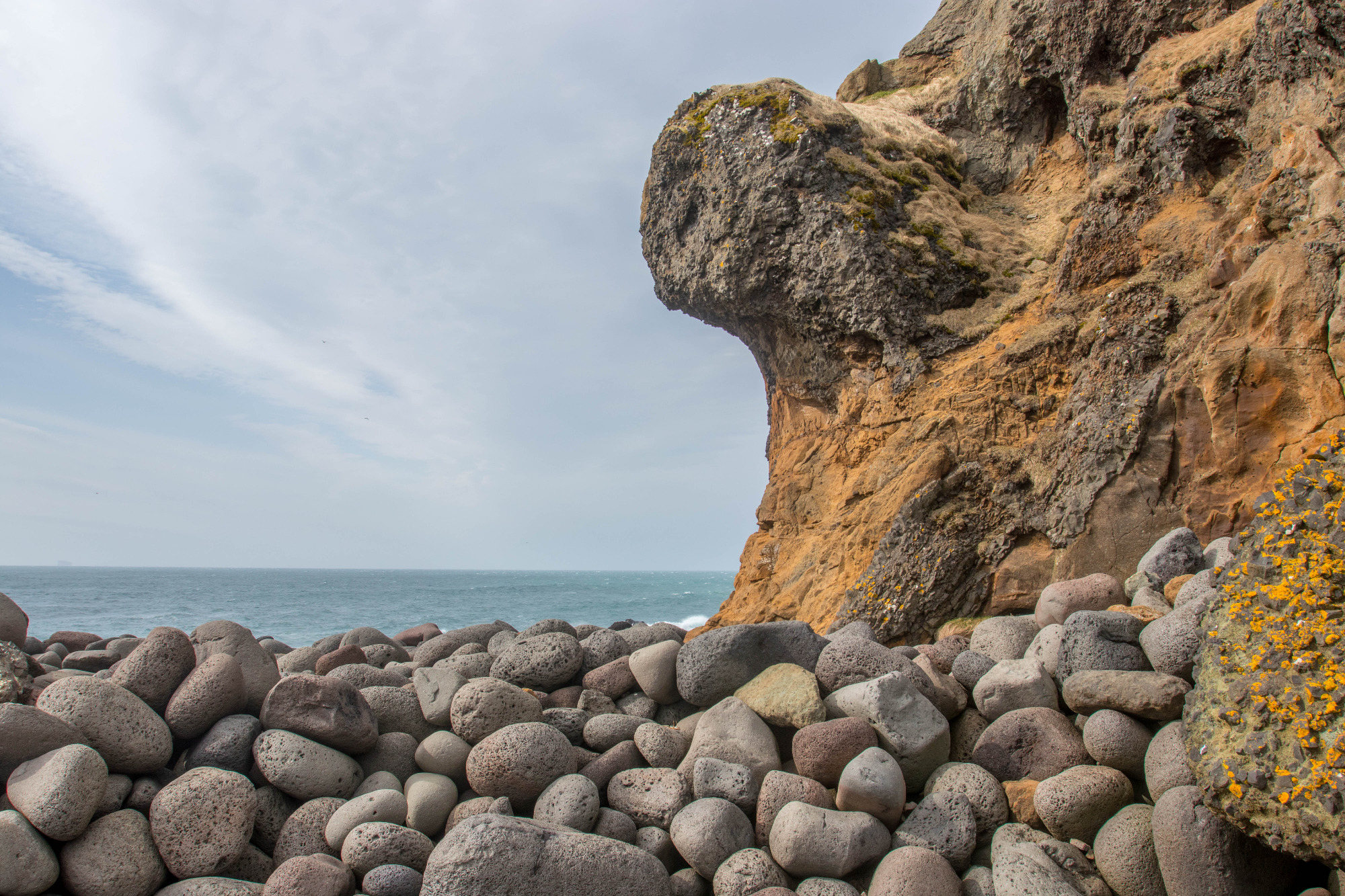
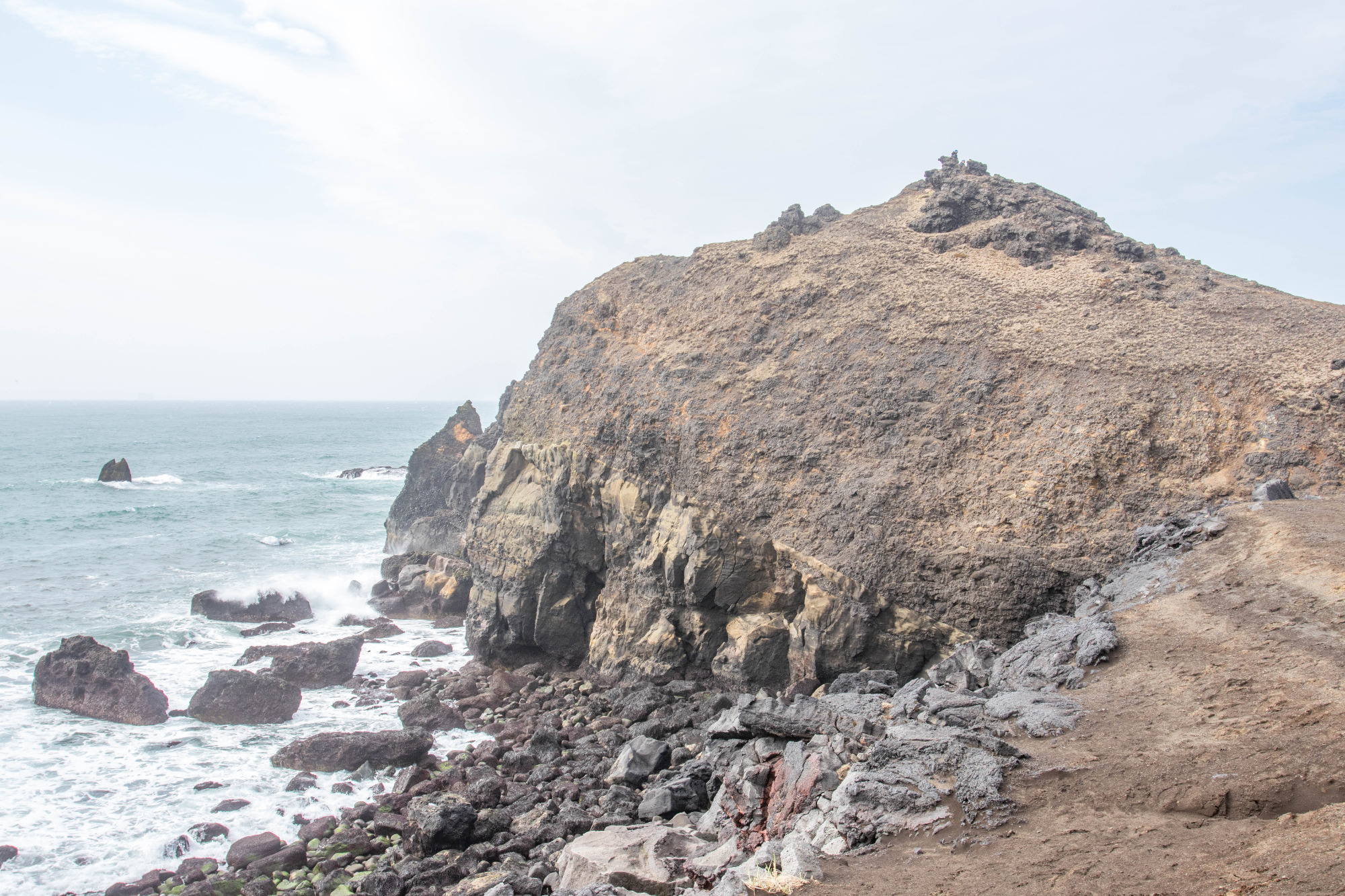
Valahnúkamöl (63°48’45.59″N 22°42’52.33″W) is a hyaloclastite mountain (icelandic:móberg) that primarily consists of pillow lavas, pillow breccia, and tuff. It reaches only 43 m above sea level and was formed during submarine fissure eruptions at the end of the last ice period (Weichselian glaciation) around 13,000 years ago. During this period the sea level was around 70 m higher compared to today (Thordarson and Höskuldsson, 2015; Guðmundsson, 2017). The entire exposure suggests a transition from subaerial to submarine volcanic flows. But not all of Valahnjúkur is volcanic, because the cove south of Valahnúkamöl features a spectacular boulder beach formed by rampart storms of the North Atlantic (Thordarson and Höskuldsson, 2015).
Southeast and east of Valahnúkamöl the eastern boundary fault of the main graben comes on land. The main graben, that may be regarded as an on-land continuation of the mid-ocean Reykjanes Ridge, has a width of 5-6 km. A small lavas shield, called Skálafell, which consists of a pahoehoe lava flow, is dissected by the boundary fault. Skálafell is the pahoehoe (basaltic) lava flow, which formed the “toe” of Reykjanes and is seen dissected by the boundary fault. This lava field has a volume of around 0.2 km3 and was formed in multiple eruptions. The lava shield was formed around 9,000 to 10,000 years ago (Guðmundsson, 2017).
On the sea, the visible pillar, called Karl, is part of a crater cone, that was formed during the Reykjanes Fires, during activation of the Yngri Stampar volcanic fissures, 800 years ago. The pillar, about 50 m tall, is just what remains of the island, the crater cone, that formed in a submarine eruption (Guðmundsson, 2017).
Guðmundsson, Á. (2017). The glorious geology of Iceland’s Golden Circle. Springer. 334 pp
Thordarson, T., and Höskuldsson, Á. (2015). Classic geology in Europe 3 – Second Edition. Dunedin. 256 pp.