The Golden Circle
Golden Circle (Gullni hringurinn)
The Golden Circle is a popular tourist route in Iceland that covers approximately 300 kilometers of stunning landscapes, natural wonders, and cultural attractions. The route is circular and starts and ends in Reykjavik, the capital city of Iceland. The three main stops on the Golden Circle are Þingvellir National Park, Geysir Geothermal Area, and Gullfoss Waterfall. Thingvellir National Park is a UNESCO World Heritage Site and is significant for its historical and geological importance. It is home to the Alþingi, the world’s oldest parliament, and also marks the boundary between the North American and Eurasian tectonic plates. Geysir Geothermal Area is known for its geysers, hot springs, and mud pots. The most famous geyser in the area is Strokkur, which erupts every few minutes and shoots boiling water up to 30 meters high. Gullfoss Waterfall is one of Iceland’s most popular and picturesque waterfalls. It is a two-tiered waterfall that drops a total of 32 meters and is surrounded by stunning natural scenery. In addition to these three main attractions, there are several other stops along the Golden Circle that are worth exploring, including Kerið volcanic crater, Hveragerði geothermal park, and Skálholt Church. Overall, the Golden Circle is a must-see destination for anyone visiting Iceland, offering a unique combination of natural beauty, geological wonders, and cultural heritage.
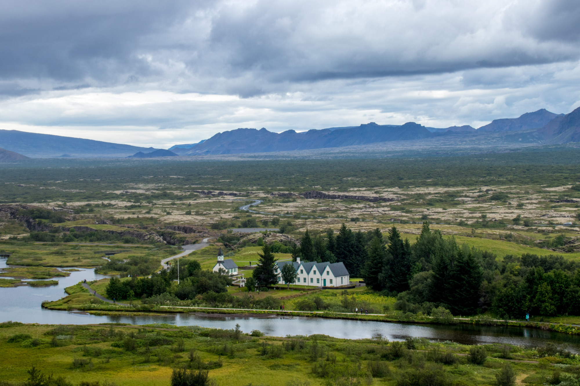
Thinvellir (Þingvellir)
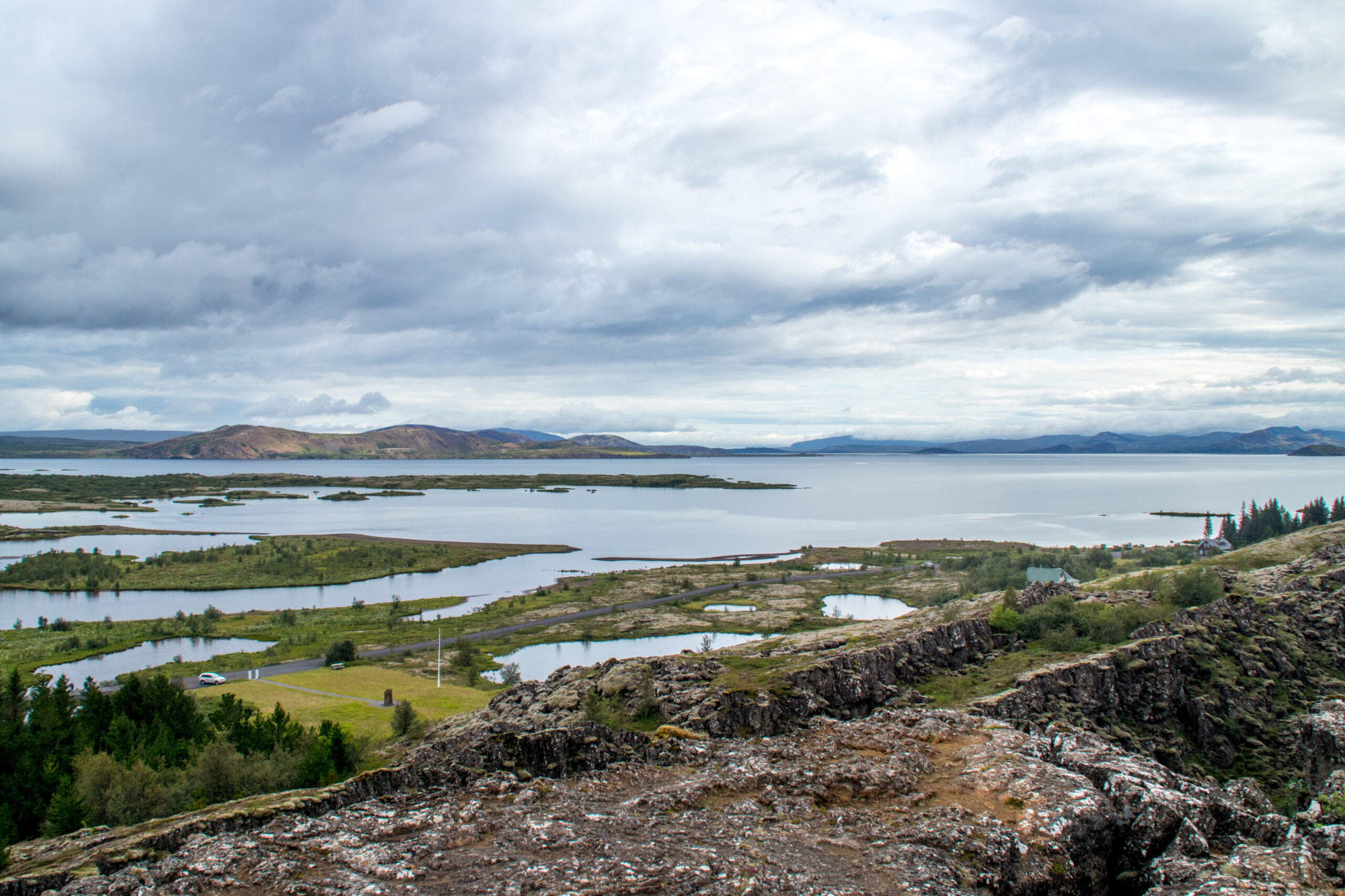
The Þingvellir National Park (64°15’19.32″N 21° 7’43.16″W) is a UNESCO World Heritage Site located in southwestern Iceland, approximately 40 kilometers east of Reykjavik. It is a significant historical and geological site that attracts visitors from all over the world. Historically, Þingvellir is important as the site of Iceland’s first parliament, the Alþingi, which was established in 930 AD. The Alþingi was held annually at Þingvellir until 1798 and is considered one of the oldest continuously running parliaments in the world.
Geologically, Þingvellir is located on the Mid-Atlantic Ridge, where the North American and Eurasian tectonic plates meet. The park is home to several unique geological features, including a large rift valley, towering cliffs, and crystal-clear freshwater springs.
One of the most popular activities in Þingvellir is hiking along the park’s many trails, which offer stunning views of the surrounding landscape. Visitors can also go snorkeling or scuba diving in the park’s Silfra fissure, which is a narrow crevice filled with crystal-clear glacial water.
Overall, Þingvellir National Park is a fascinating and beautiful destination that offers visitors a unique combination of history and natural wonders.
Geysir
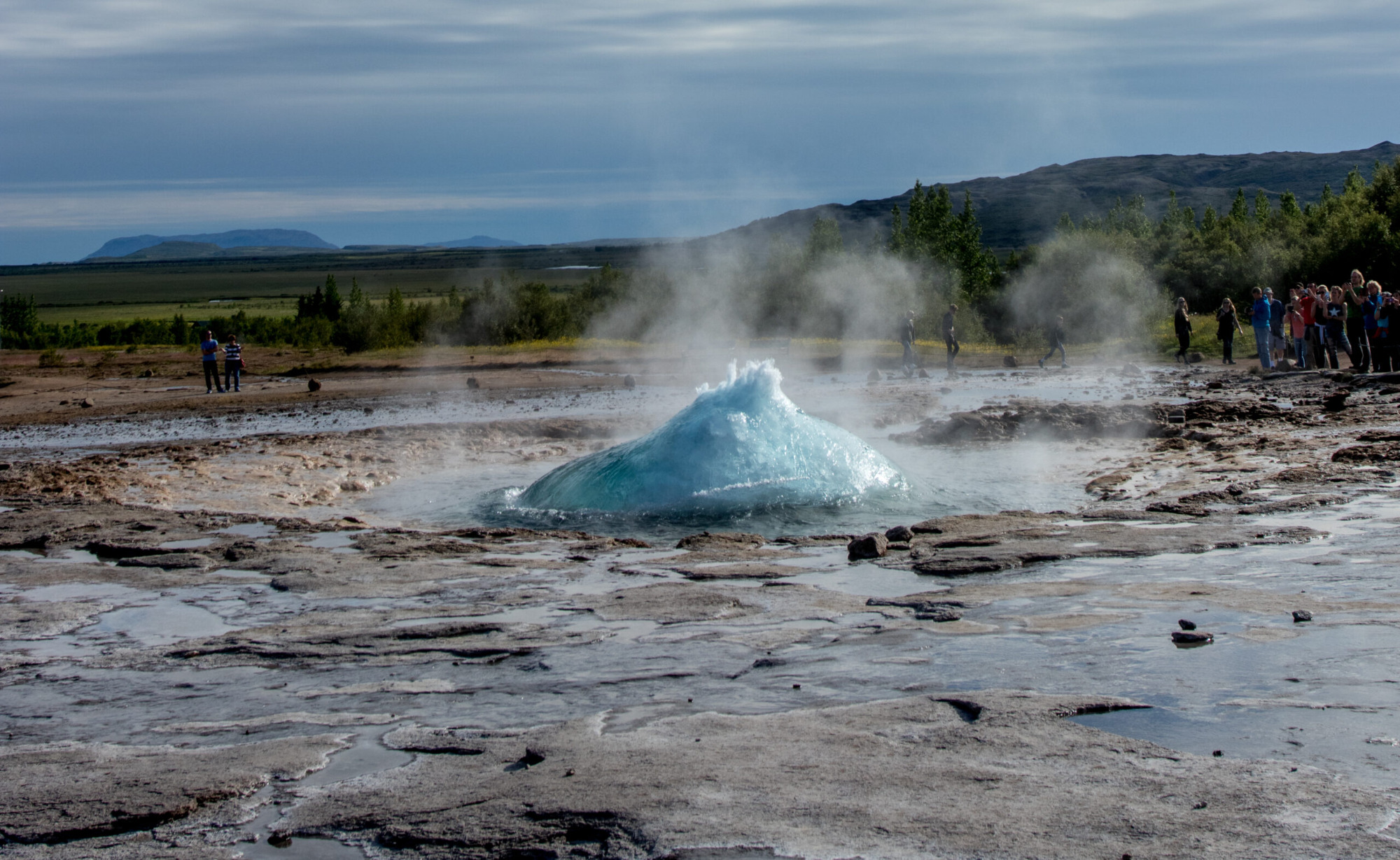
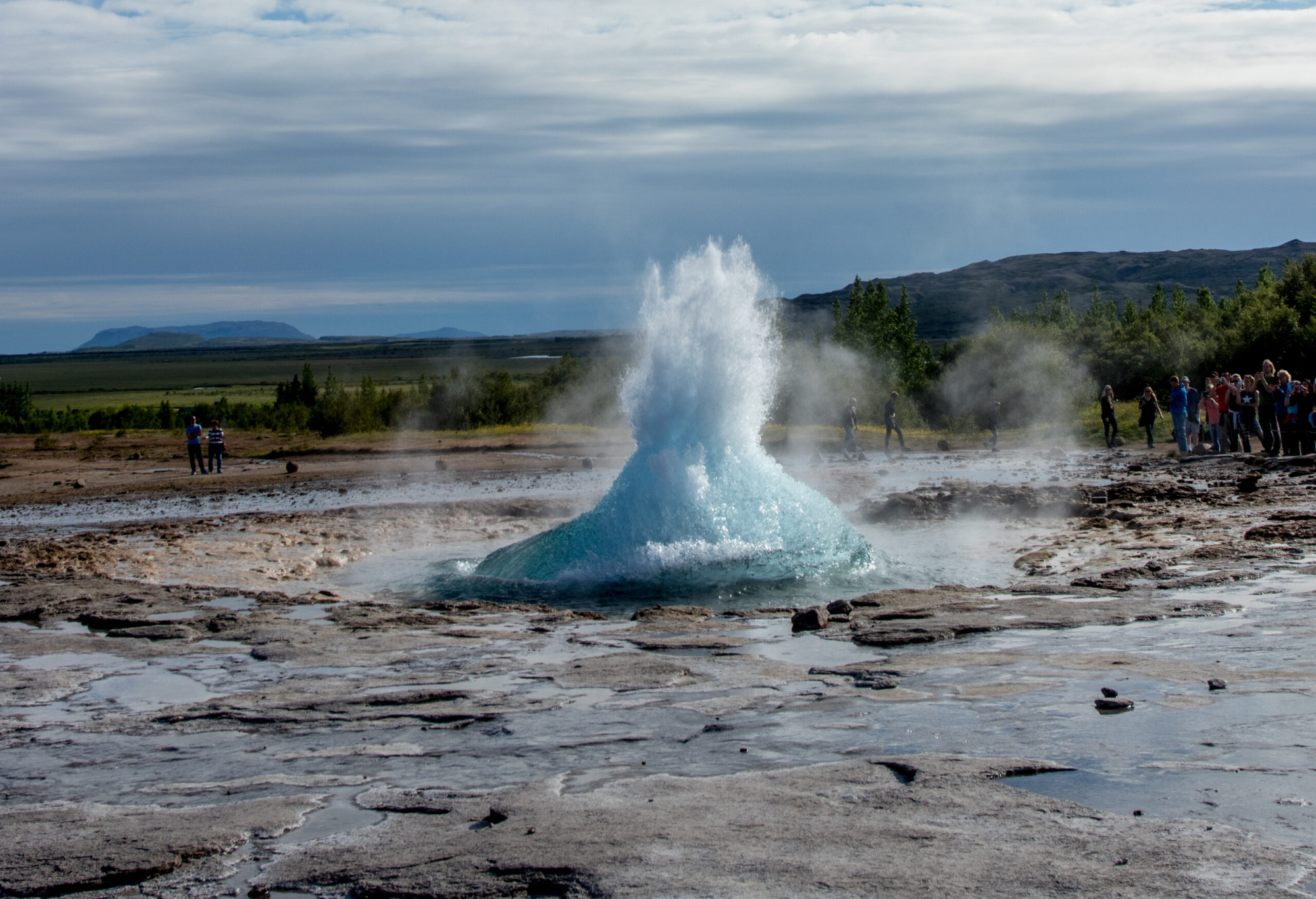
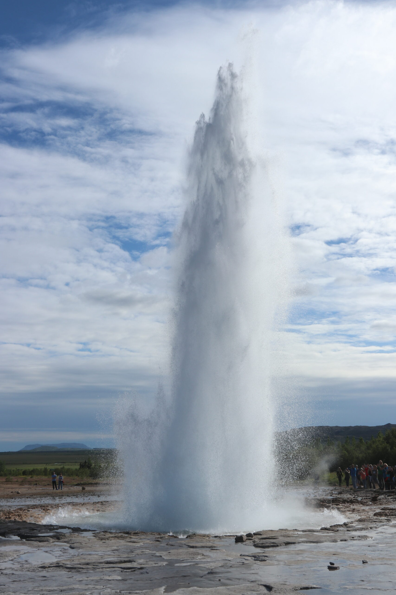
Geysir (64°18’35.56″N 20°18’4.60″W) is a famous hot spring located in southwestern Iceland. It is known for its powerful eruptions of boiling water, which can shoot up to 70 meters in the air. The word “geyser” actually comes from the Icelandic word “geysir,” which means “to gush.”
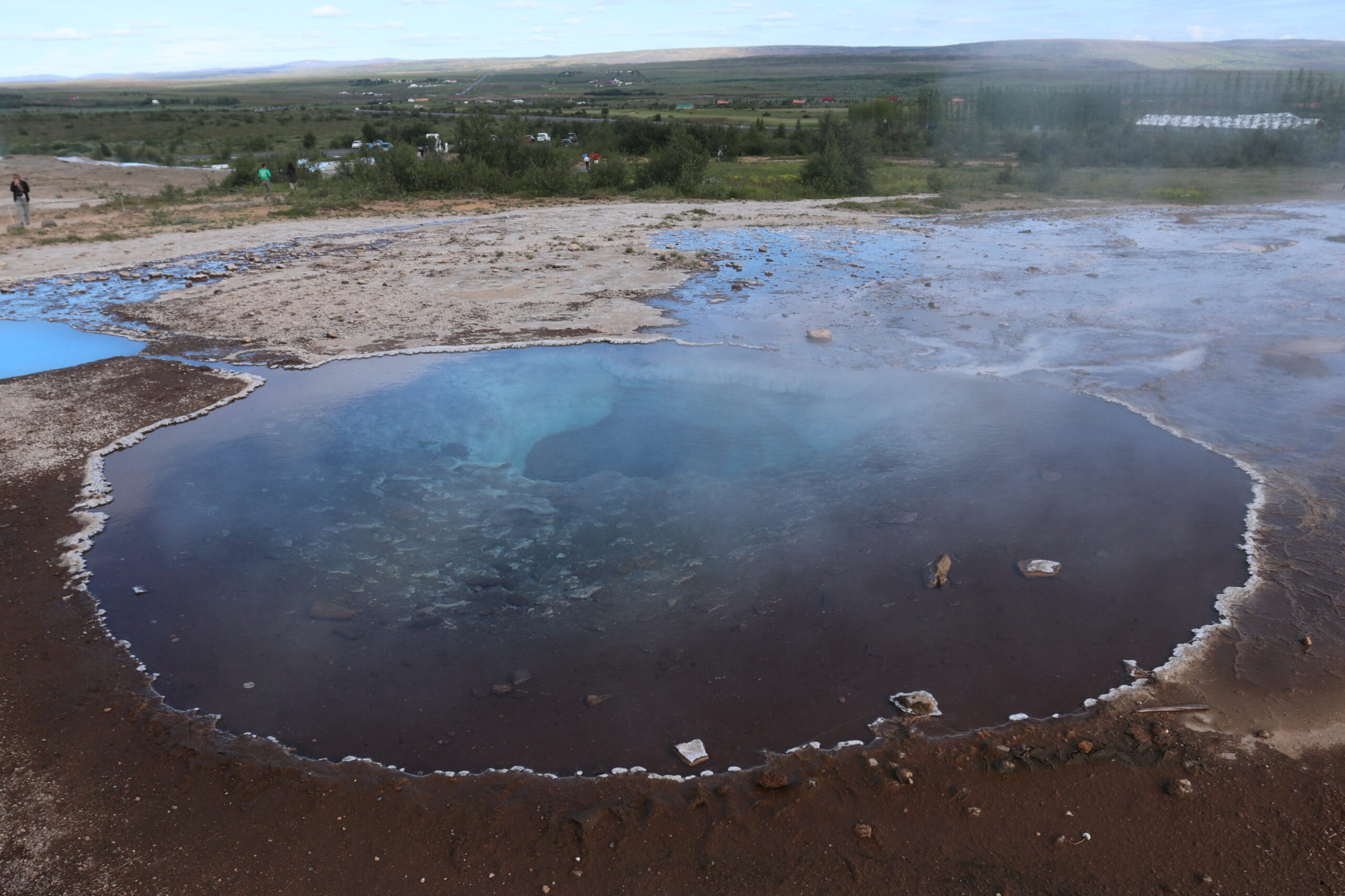
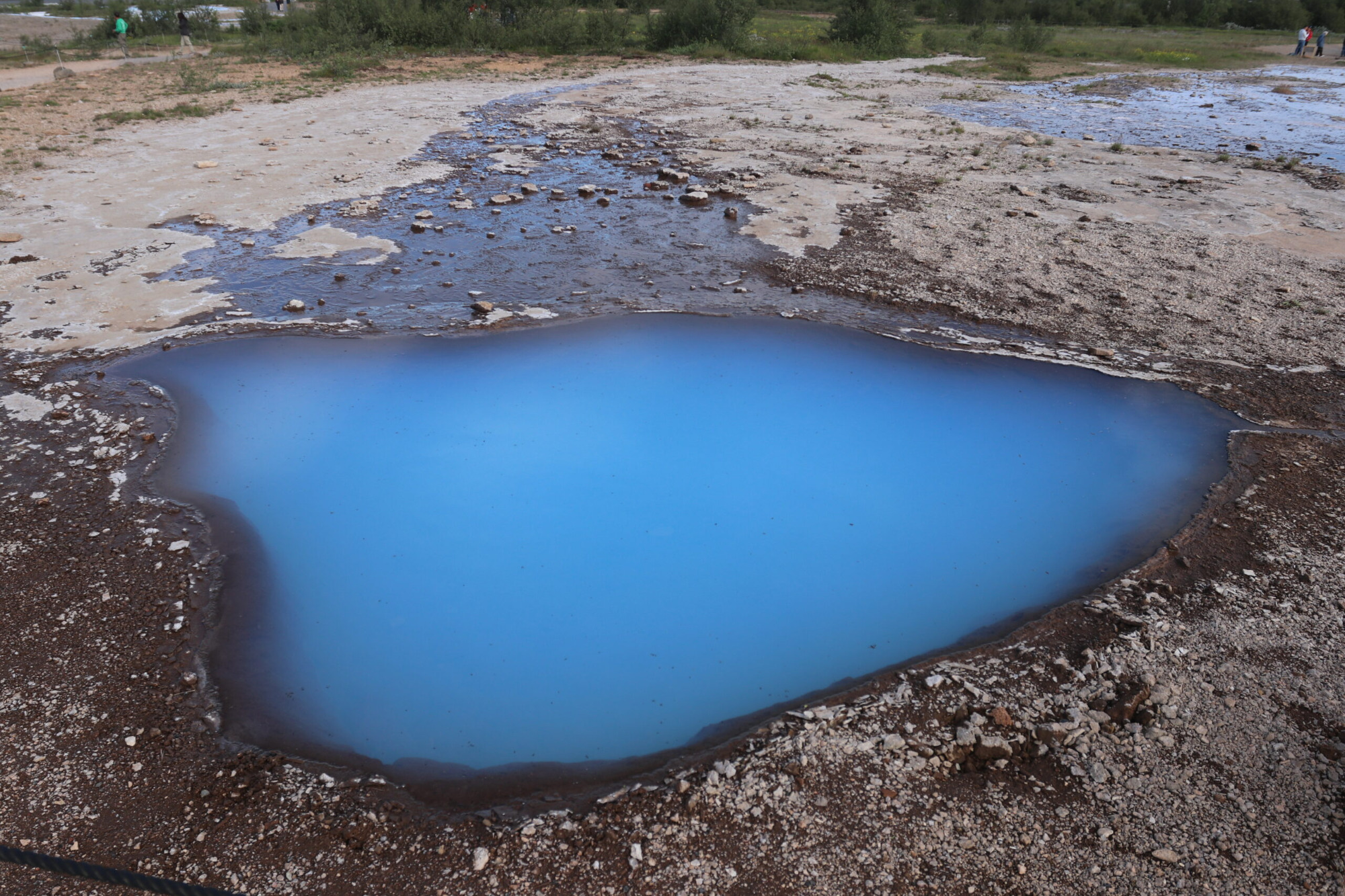
Geysir is part of a geothermal area called the Haukadalur Valley, which is situated on the Mid-Atlantic Ridge. The area is highly active with hot springs, mud pools, and other geothermal features. The Geysir itself is not as active as it once was, but it still erupts occasionally, and its smaller neighbor, Strokkur, erupts more frequently, shooting water up to 30 meters in the air every few minutes.
Geysir has been a popular tourist destination since the 19th century, and it continues to attract visitors from all over the world. Visitors can witness the eruptions of Strokkur, explore the geothermal landscape, and even take a dip in the nearby hot springs. The area is also home to a visitor center, gift shop, and restaurant, making it a convenient and enjoyable stop for travelers exploring the Golden Circle route in Iceland.
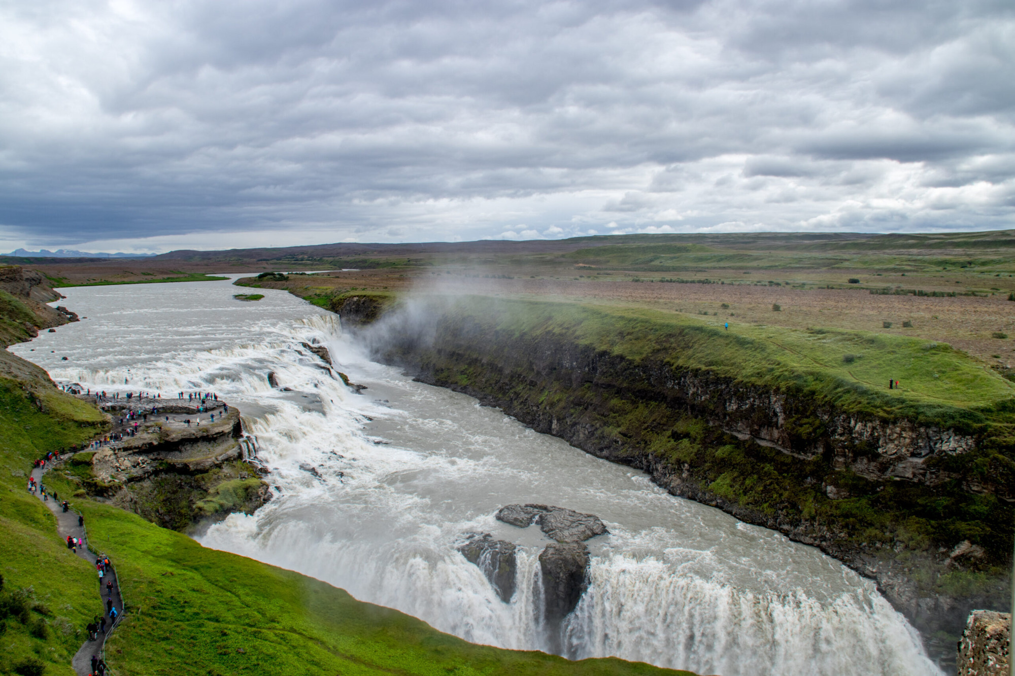
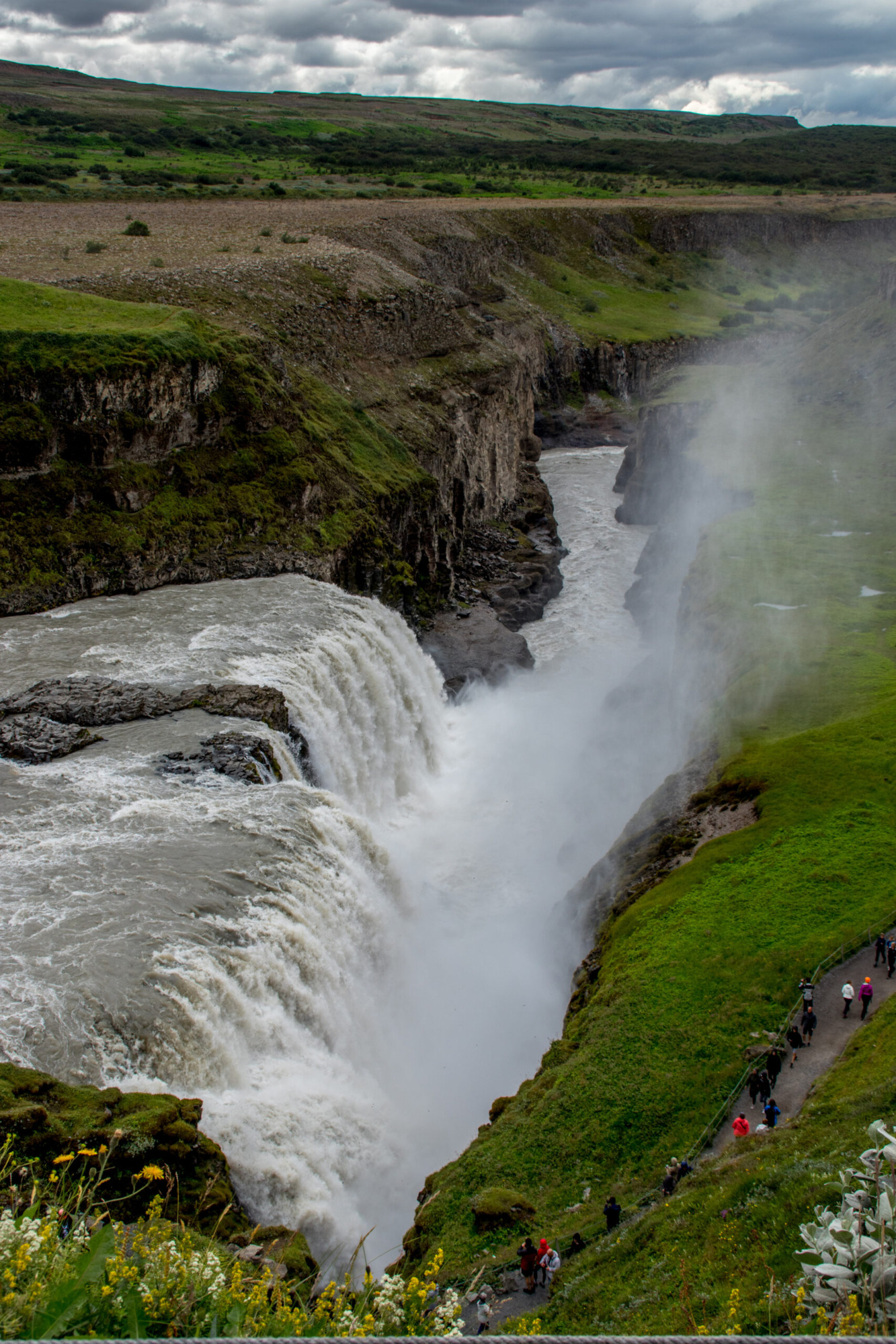
Gullfoss
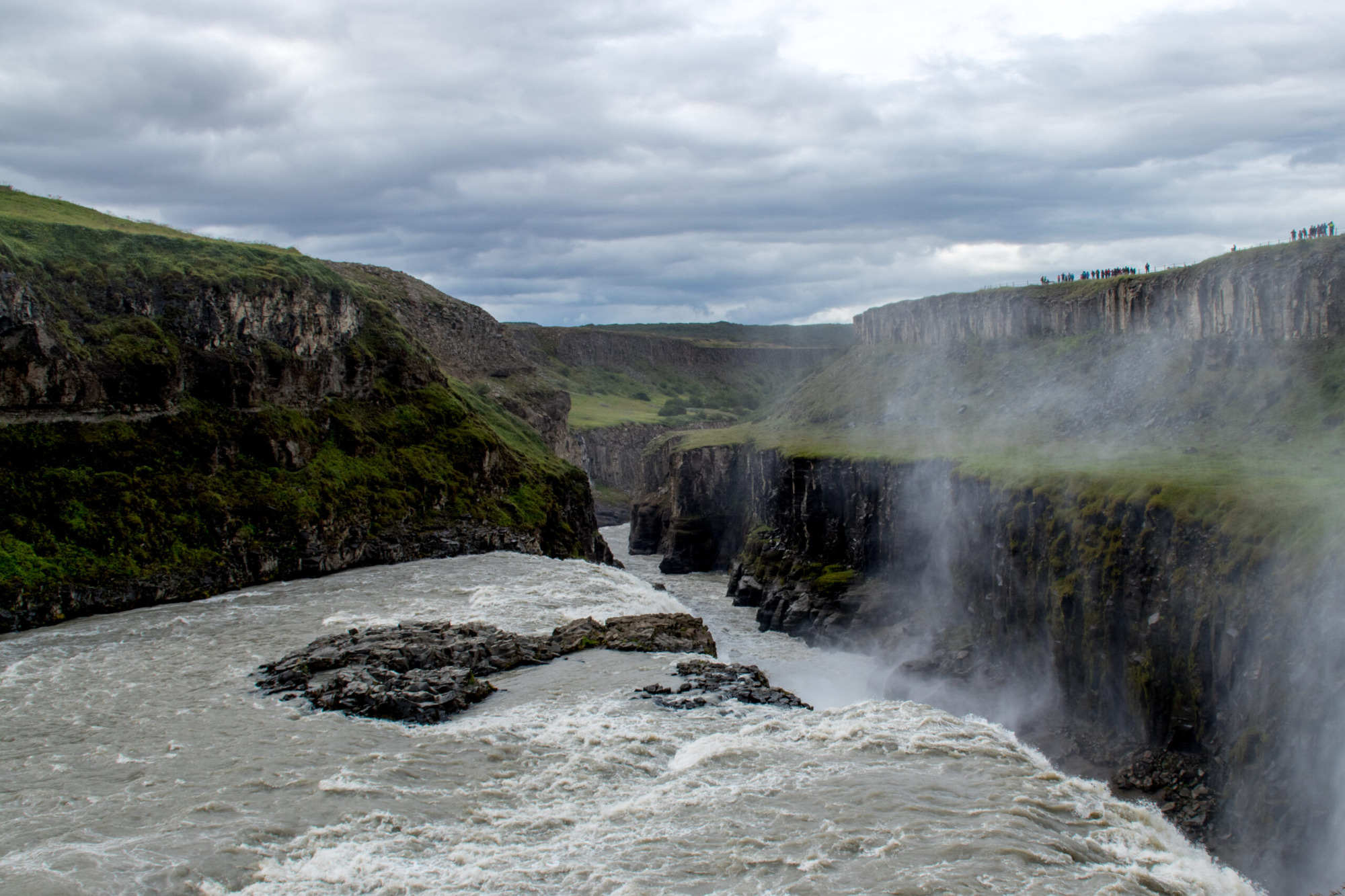
Gullfoss (64°19’31.44″N 20°7’50.68″W) is a stunning waterfall located in the southwestern region of Iceland, near the Geysir geothermal area. Its name translates to “Golden Falls” in English, and it is widely considered to be one of the most beautiful waterfalls in Iceland. The waterfall is formed by the Hvítá river, which flows through a canyon before dropping in two stages over a total distance of 32 meters. The water plunges into a crevice, creating a powerful roar and a misty spray that can be seen from a distance. Gullfoss has been a popular tourist destination since the early 20th century, and it continues to attract visitors from around the world. In addition to its natural beauty, the waterfall has played an important role in Icelandic history and culture. Legend has it that a farmer’s daughter named Sigríður Tómasdóttir fought to protect the waterfall from being developed for hydroelectric power in the early 20th century, eventually convincing the Icelandic government to preserve it as a national treasure. Today, visitors can view Gullfoss from a variety of vantage points, including a viewing platform near the waterfall’s edge. The area surrounding Gullfoss is also home to hiking trails, hot springs, and other natural attractions, making it a popular stop for tourists exploring the Golden Circle route in Iceland.
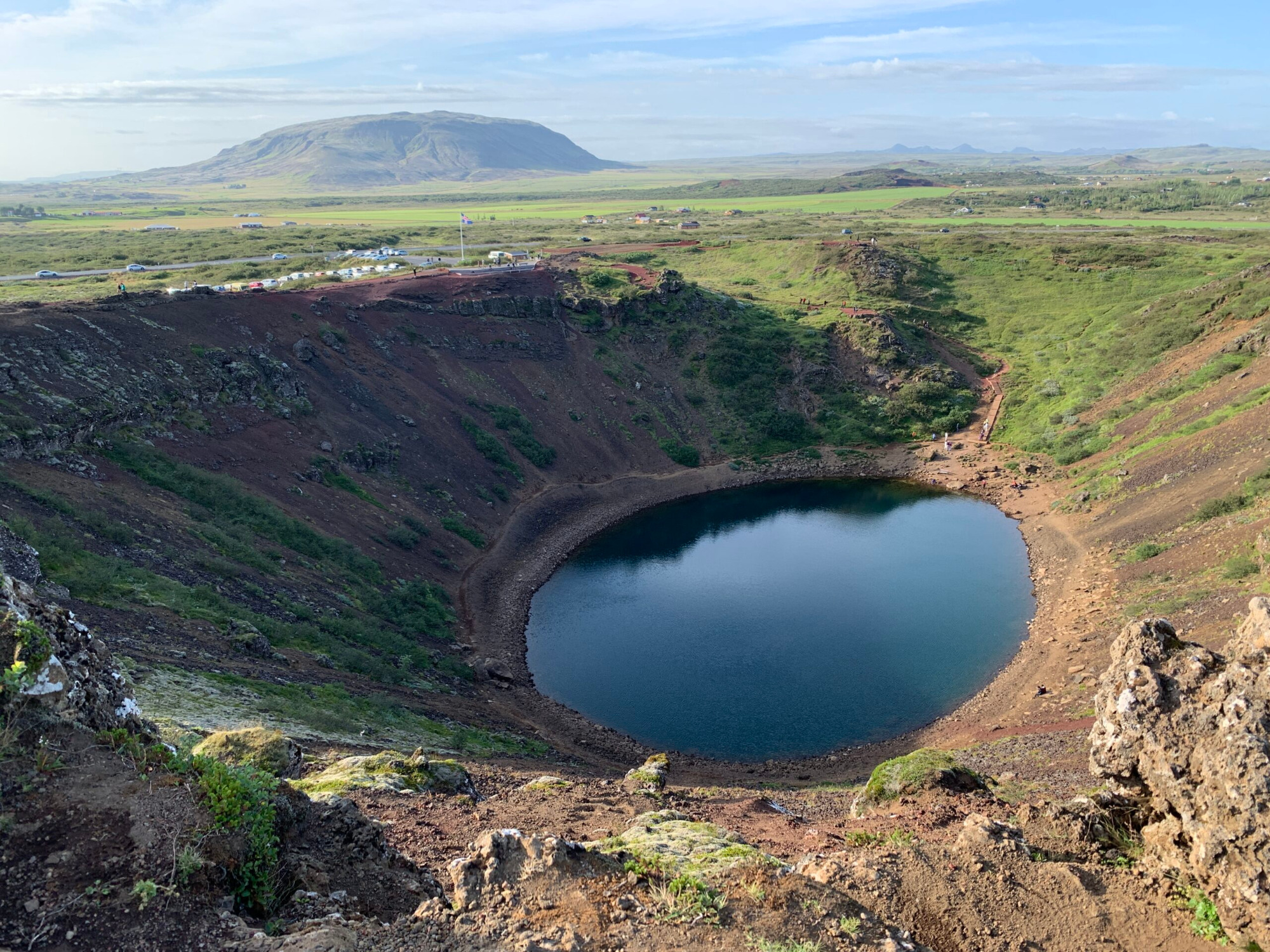
Kerið
Kerið (64°2’26.73″N 20°53’4.92″W) is a crater of scoria and splatter material of basaltic rocks. Scoria is broken and stiff lava fragments (mm – cm size). The rocks were derived from the spray of the lava fountains during the fissure eruption, that formed Kerið. When scoria fragments hit the ground, they are already solidified and stiff. In contrast, spatter fragments, which are also derived from the spray of the lava fountain, hit the ground when they are still hot and plastic (“pancake-like” shape). The scoria is mostly black or red in colour. The black colour is the most common and the red colour is due to oxidation (Guðmundsson, 2017).
Kerið belongs to the volcanic field, called Grímsnes Volcanic Field. The whole field was generated in many eruptions that occured around 8,000 – 10,000 years ago and formed several crater cones by fissure eruptions. Kerið itself was formed around 9,000 years ago and was supplied with magma from a north-northeast trending volcanic fissure (about 900 m long). The crater has a small lake inside, which is based on the reason that the water level marks the water table, the surface of the groundwater (Guðmundsson, 2017).
Guðmundsson, Á. (2017). The glorious geology of Iceland’s Golden Circle. Springer. 334 pp.
Wir benötigen Ihre Zustimmung zum Laden der Übersetzungen
Wir nutzen einen Drittanbieter-Service, um den Inhalt der Website zu übersetzen, der möglicherweise Daten über Ihre Aktivitäten sammelt. Bitte überprüfen Sie die Details in der Datenschutzerklärung und akzeptieren Sie den Dienst, um die Übersetzungen zu sehen.